You are viewing ARCHIVED content published online before Jan. 20, 2025. Please note that this content is NOT UPDATED,
and links may not work. Additionally, any previously issued diversity, equity, inclusion or gender-related guidance on
this webpage should be considered rescinded. For current information, visit
News Items | Bureau of Safety and Environmental Enforcement.
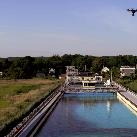
LEONARDO, N.J. - In an effort to enhance the ability to detect and measure oil spills offshore, the Bureau of Safety and Environmental Enforcement (BSEE) and National Oceanic and Atmospheric Administration begins today a study of multiple remote sensing systems at BSEE’s Ohmsett facility. The three-phase study employs Ohmsett’s 660-feet long, 2.6 million gallon capacity saltwater test tank. Spill responders will be able to use the study results to better monitor and measure oil slicks and emulsions in the marine environment and in the process improve offshore spill response operations.
In the study’s first phase, researchers will compare multiple remote sensing systems to determine how well each detects oil/water emulsion mixtures and measures oil thickness. The remote sensors will view emulsified oil in the Ohmsett tank from multiple angles, heights and through different mediums to validate sensor capabilities. Above the water, sensors on the “Ohmsett Bridge” will provide a close-up view of the water surface while a remotely-operated vehicle will provide an underwater view. Simultaneously, remote sensors mounted on an Unmanned Aerial Vehicle, a fixed-wing aircraft, and a helicopter will take measurements. Three satellites equipped with remote sensors will also pass overhead and provide space-based observations.
The study’s second phase, planned for late 2016, will allow the research team to measure sensor performance in an open water environment and compare that data to controlled conditions at the Ohmsett tank. Development of operational methods and procedures for processing and interpreting the capabilities of the sensors will occur in the third and final phase of the study.
